Saclay
The Saclay station is is a semi-urban site, located 20 km southwest of Paris. This station is surrounded by agricultural fields (47.4%), forests (25.0%), and urban residential areas (22.2%) (source: INSEE, National Institut of Statistic and Economic Study, 2008, http://www.insee.fr). The dominant wind direction is south-west (35% of the time), with a wind speed between 5 and 10 m.s-1. Only 14% of the time during most of the year, but 35% of the time in spring, the wind comes from Paris (north-east direction), transporting polluted air masses. The site is located ~20 km south-west of the Paris center on the Plateau de Saclay. The closest village and small town are Saint-Aubin (673 inhabitants) and Gif-sur-Yvette (21,352 inhabitants), located 500 m north-west and 1 km south of the station, respectively. There is a high traffic road (N118) during the rush hours located 1km from the tower.

Quick access:
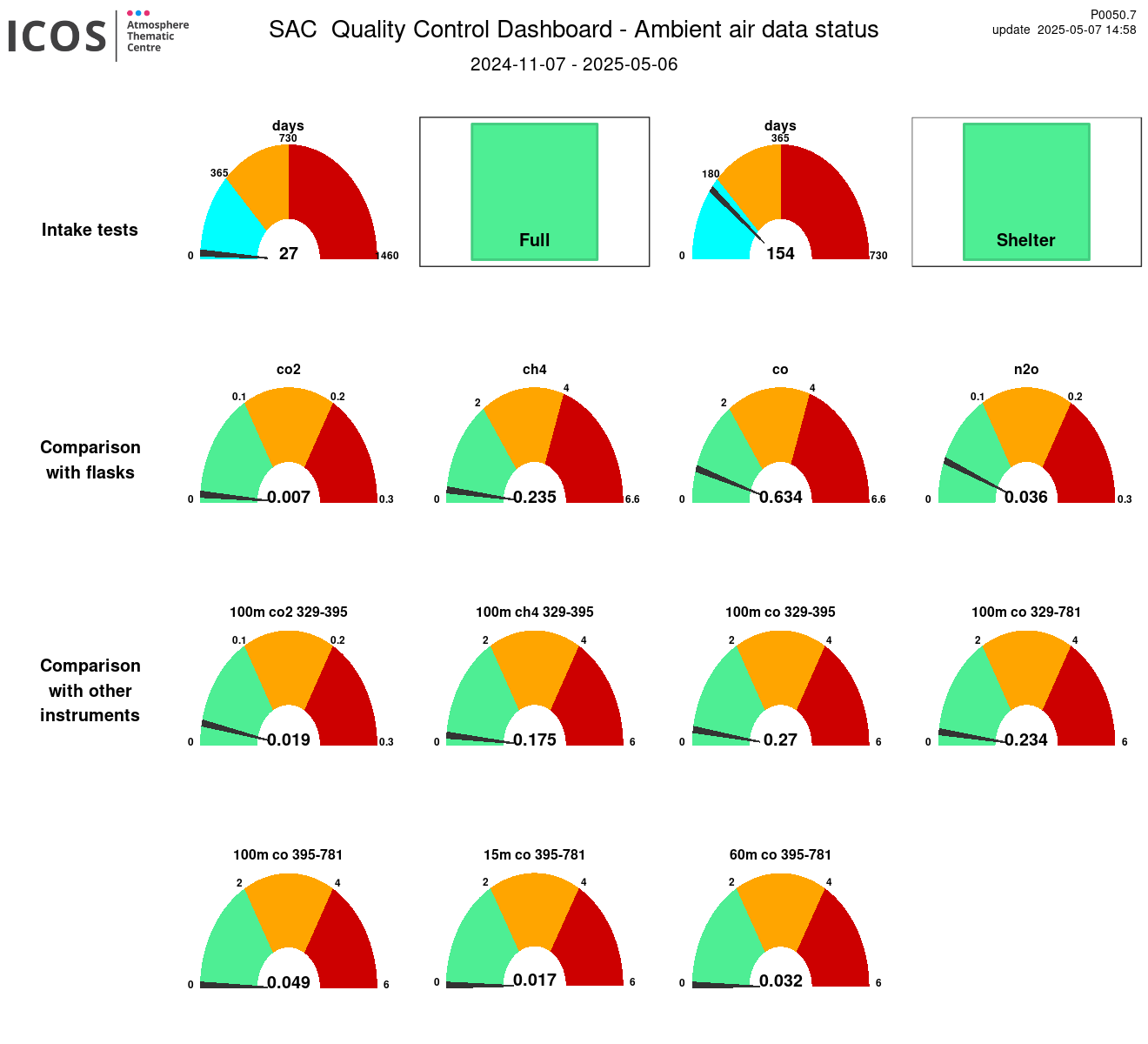
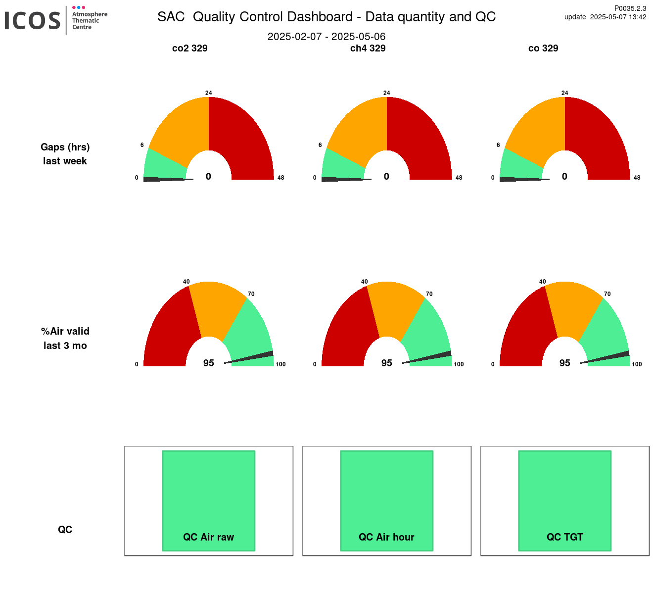
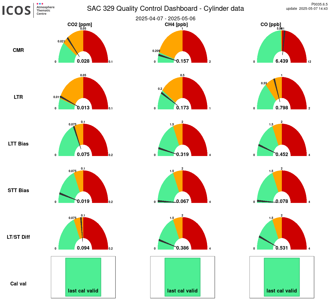
Instrument id: 329

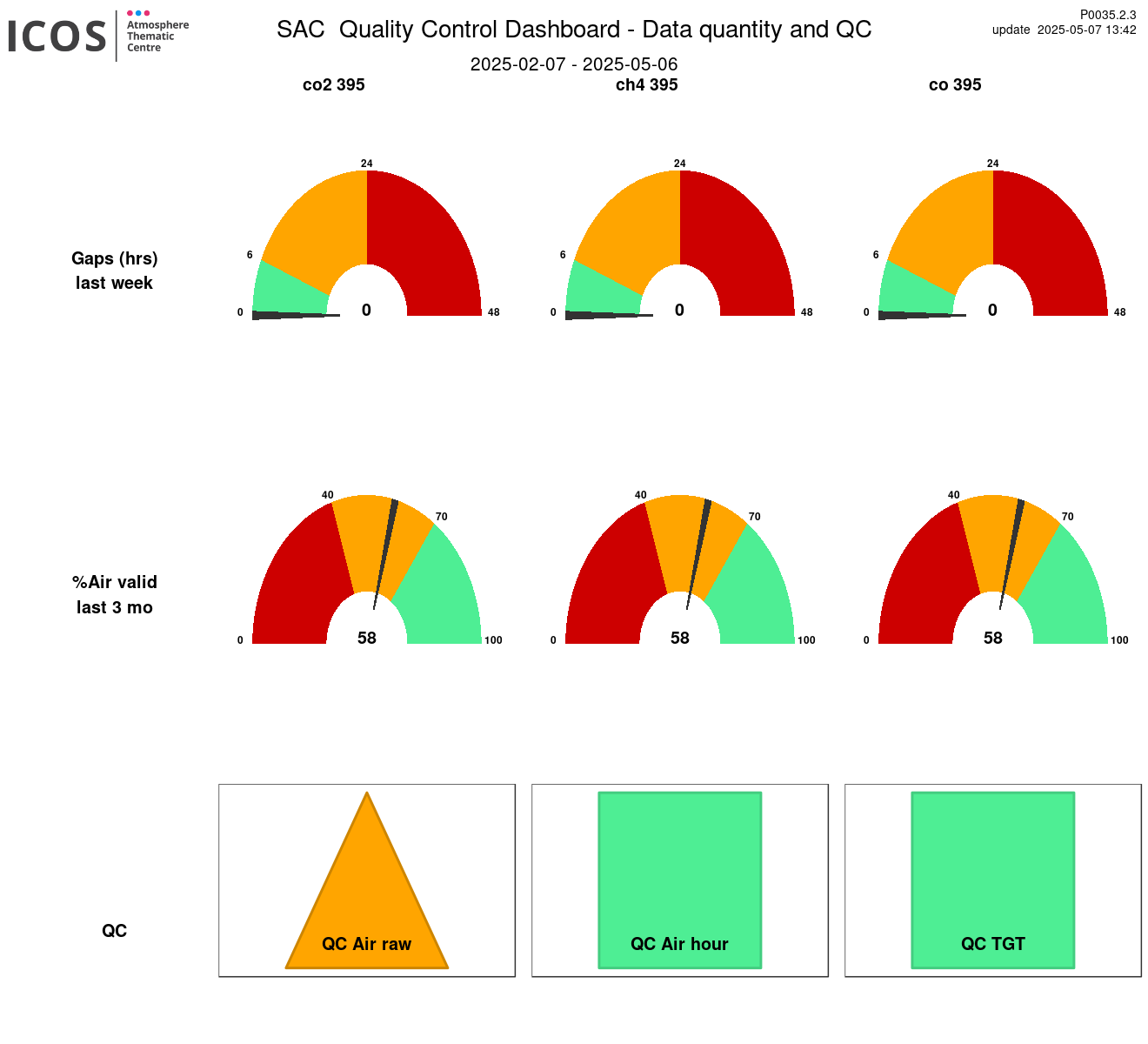
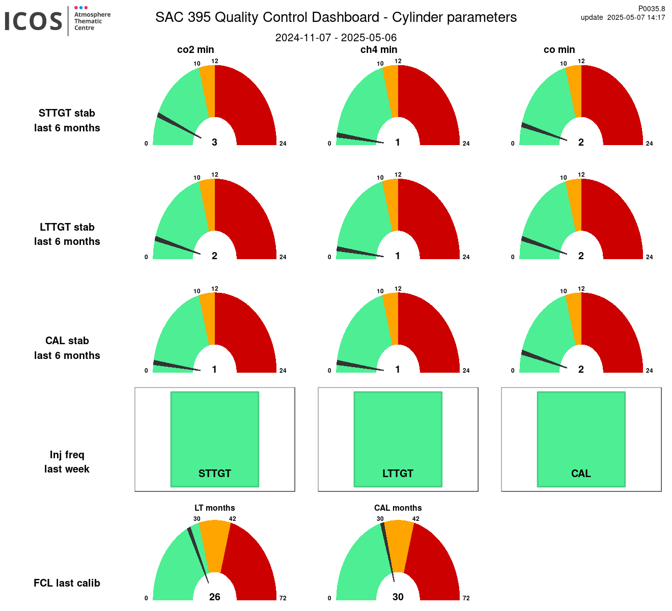
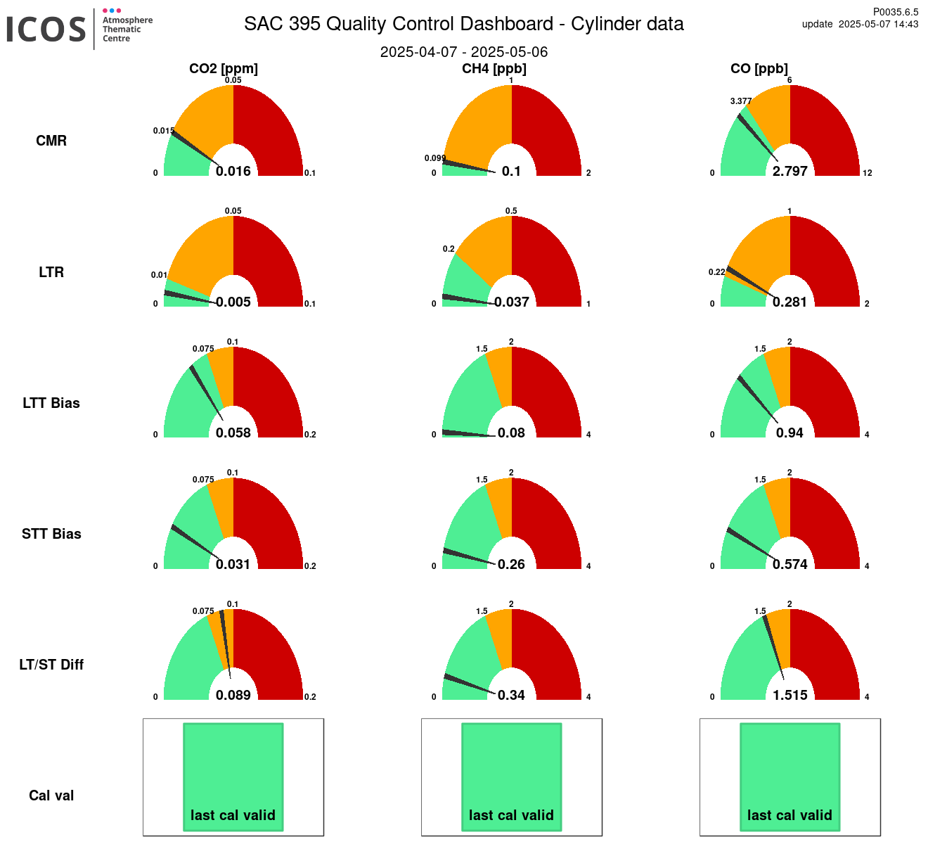
Instrument id: 395
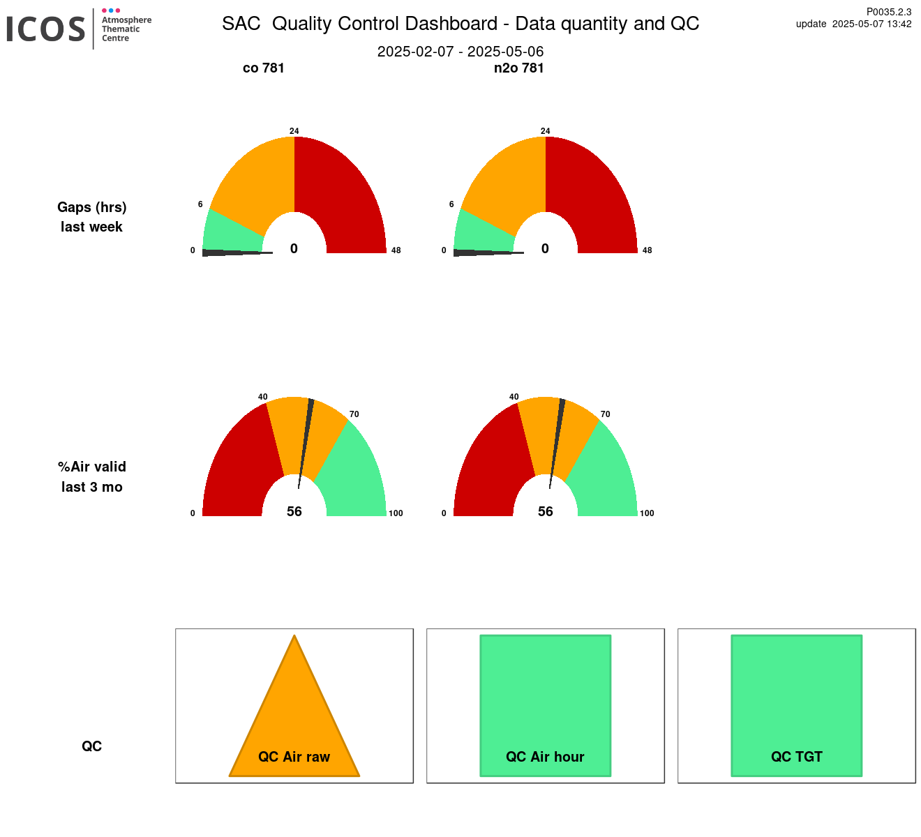
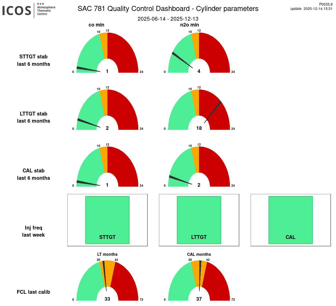
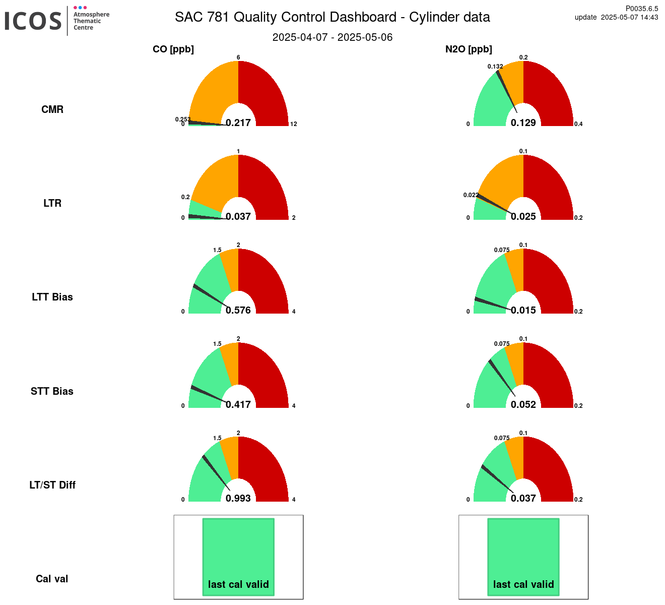
Instrument id: 781
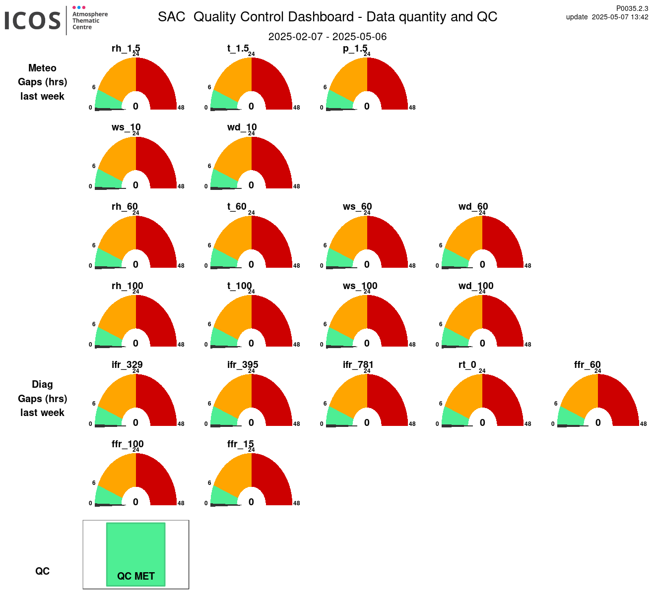
MET